



Ontario's weather could get more chaotic with blizzards, ice storms & a 'weather bomb'
Brace yourselves, Ontario! 😱
If you thought Canada's weather forecast was going to calm down ahead of the new year, think again! Ontario's weather, in particular, is serving up another round of messy conditions as a powerful storm and possible "weather bomb" moves in just days after the holidays.
According to a new report from The Weather Network, a high-impact Colorado low is sweeping across the province on Sunday, bringing a chaotic mix of rain, freezing rain, strong winds and heavy snow to different regions.
From Toronto to Timmins and Ottawa, the storm is expected to affect travel, raise the risk of flooding, and could cause power outages as we head into the final days of 2025.
Following closely on the heels of Ontario's Boxing Day storm, this new system is tapping into intense southern moisture and rapidly intensifying as it approaches the Great Lakes.
According to TWN, the low-pressure system could even meet "weather bomb" criteria, which refers to a storm that strengthens very quickly in a short amount of time.
"Blizzard conditions, an ice storm, and flooding rains are all possible in different corners of Ontario as this complex and hazardous system pushes through the province," the report warns.
In response, Environment Canada has issued widespread weather warnings across the province, including rainfall, freezing rain, winter storm and wind alerts, depending on the region.
In southern Ontario, including Toronto, Peel, York, Durham, and parts of the Golden Horseshoe, a Yellow Rainfall Warning is in effect. Rainfall totals could range from 20 to 40 millimetres by Monday morning, with the heaviest periods expected Sunday afternoon through the evening.
Due to the frozen ground, much of this rain will not be absorbed, increasing the risk of localized flooding. Environment Canada is advising residents to clear storm drains where possible and avoid low-lying areas, as water may pool on roads and walkways.
Freezing rain is also possible in some areas early on before transitioning to rain later on Sunday.In eastern Ontario, including Ottawa and parts of the Ottawa Valley, "significant" freezing rain is expected to last for 8 to 15 hours or more, potentially leading to ice accretion of 5 to 15 millimetresm.
According to TWN, this could weigh down trees and power lines, leading to potential outages and dangerous travel conditions.
Environment Canada has issued several weather alerts in response, noting that "Roads and walkways will likely become icy and slippery. Travel will likely be hazardous, and some routes will likely be impassable."
The weather warning adds, "There may be a significant impact on rush hour traffic. Prolonged utility outages are likely."
Elsewhere, northern and northeastern Ontario are under warnings for heavy snow and blizzard conditions, especially around Timmins, Wawa, and Chapleau.
These areas could see as much as 40 to 60 centimetres of snow by the time the storm winds down on Monday night. Per TWN, the combination of snow and strong winds will likely create whiteout conditions and lead to highway closures in some regions.
In southern Ontario, another concern is the risk of a flash freeze. As the rain winds down on Monday, colder air will quickly move in behind the system. In areas like Hamilton and Niagara, temperatures could drop by as much as 10 degrees Celsius within just a couple of hours. This sudden temperature plunge could cause standing water to freeze rapidly, creating slick roadways and hazardous conditions.
Strong winds are also forecast to develop on Monday, particularly along the Great Lakes. Wind gusts of 70 to 80 kilometres per hour are expected in places like Toronto, Hamilton and Niagara.
The Weather Network reports that gusts could reach up to 110 kilometres per hour near Lake Erie. These winds may knock down tree branches and cause additional power outages, particularly in areas where ice build-up is already stressing infrastructure.
Along the lakeshores, waves could build to five metres or more, with sudden ice shoves possible in some areas. As the winds continue into Tuesday, lake-effect snow squalls could develop in parts of southern Ontario, particularly in snowbelt regions. Blowing snow could further impact travel as residents prepare for New Year's Eve.
For the latest updates and weather alerts, Ontarians are advised to monitor Environment Canada's updates and stay informed through local forecasts.
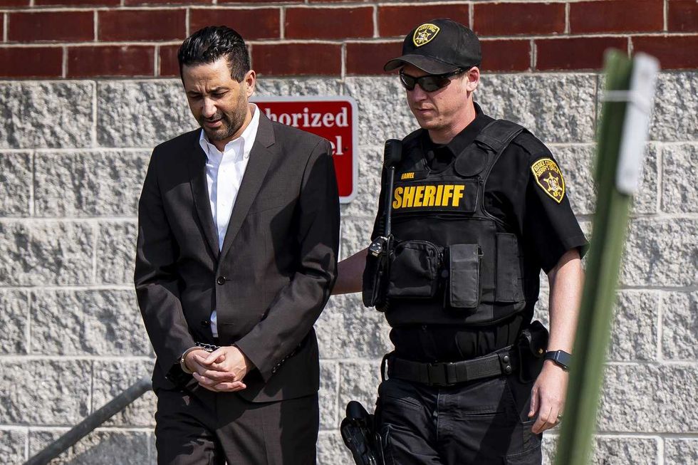 Luciano Frattolin is taken away in custody from the Essex County Court in Elizabethtown, New York on Friday, July 24, 2026. Luciano Frattolin charged with 2nd-degree murder and concealment of a human corpse.
THE CANADIAN PRESS/Christopher Katsarov
Luciano Frattolin is taken away in custody from the Essex County Court in Elizabethtown, New York on Friday, July 24, 2026. Luciano Frattolin charged with 2nd-degree murder and concealment of a human corpse.
THE CANADIAN PRESS/Christopher Katsarov Police officers open the back of a recovered truck during a press conference regarding Project 24K, a joint investigation into the theft of gold from Pearson International Airport, in Brampton, Ont., on Wednesday, April 17, 2024.
THE CANADIAN PRESS/Arlyn McAdorey
Police officers open the back of a recovered truck during a press conference regarding Project 24K, a joint investigation into the theft of gold from Pearson International Airport, in Brampton, Ont., on Wednesday, April 17, 2024.
THE CANADIAN PRESS/Arlyn McAdorey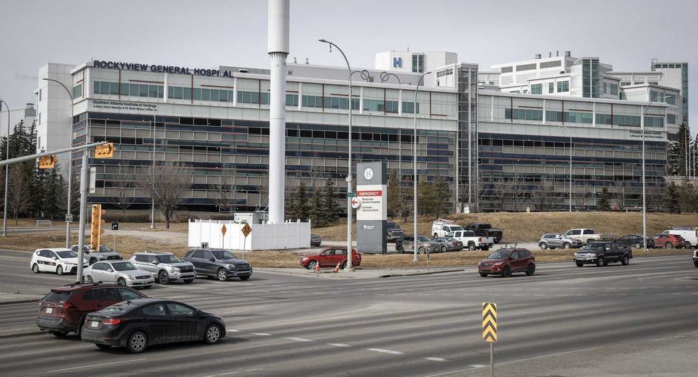 The Rockyview General Hospital is pictured in Calgary, Thursday, March 20, 2025.
THE CANADIAN PRESS/Jeff McIntosh
The Rockyview General Hospital is pictured in Calgary, Thursday, March 20, 2025.
THE CANADIAN PRESS/Jeff McIntosh This composite image shows, left to right, B.C. NDP Leader David Eby in Vancouver, on April 13, 2026; B.C. Conservative interim Leader Lorne Doerkson, in Vancouver, on Sept. 22, 2026; B.C. Green Party Leader Emily Lowan in Victoria, on Sept. 23, 2026.
THE CANADIAN PRESS/Darryl Dyck, Rich Lam, Kevin Light
This composite image shows, left to right, B.C. NDP Leader David Eby in Vancouver, on April 13, 2026; B.C. Conservative interim Leader Lorne Doerkson, in Vancouver, on Sept. 22, 2026; B.C. Green Party Leader Emily Lowan in Victoria, on Sept. 23, 2026.
THE CANADIAN PRESS/Darryl Dyck, Rich Lam, Kevin Light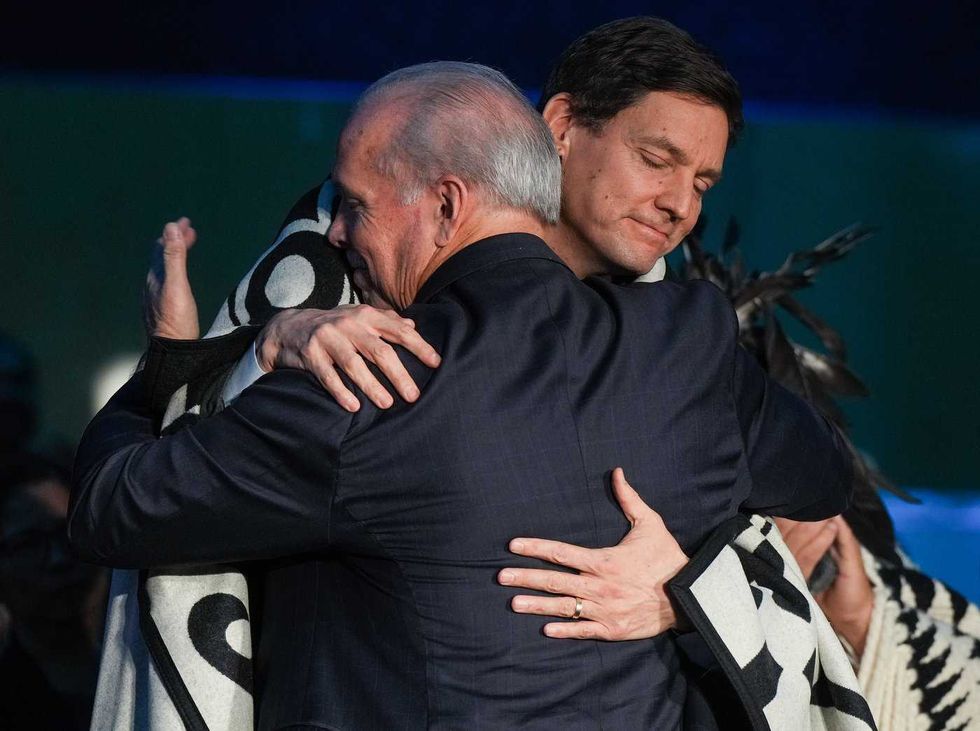 B.C. Premier David Eby, back, and outgoing premier John Horgan embrace during a swearing in ceremony where Eby became the province's 37th premier at the Musqueam Nation, in Vancouver, B.C., Friday, Nov. 18, 2022.
THE CANADIAN PRESS/Darryl Dyck
B.C. Premier David Eby, back, and outgoing premier John Horgan embrace during a swearing in ceremony where Eby became the province's 37th premier at the Musqueam Nation, in Vancouver, B.C., Friday, Nov. 18, 2022.
THE CANADIAN PRESS/Darryl Dyck